









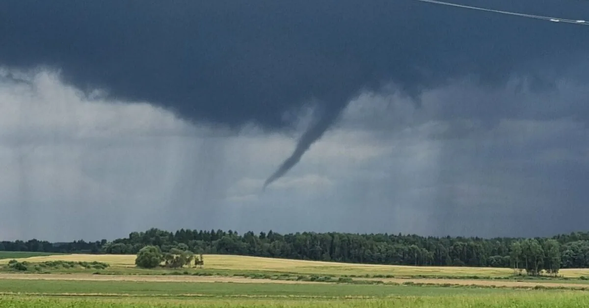
Images from Raseiniai district were shared by Ernesta Gailevičiūtė in the Facebook group “Weather Enthusiasts”.
Read more A specialist explained how to safely use bee products and why self-medication can end tragically
As stated next to the photo and video, this was captured on Tuesday, July 21, in the evening, at 7:35 PM, in Raseiniai district.
Comments on the post also reported heavy rain in Raseiniai district, with people complaining that they were “swimming like never before”.
Meteorologist Gytis Valaika also published the image on his Facebook account “Weather and Climate in Lithuania”.
“A funnel-shaped cloud like this was recorded a few kilometers east of Raseiniai on Tuesday evening.
It is not yet clear whether it touched the ground even for a short time (i.e., whether a tornado had formed; if it did not reach the ground, then it is only a nascent tornado),” he wrote.
There were more frightening natural phenomena on Tuesday. Impressive hail fell in Piniava, Panevėžys district.
Short Rains Expected
Wednesday, according to the Lithuanian Hydrometeorological Service, will also have short rains in many places, with possible thunderstorms. Wind northwest, west, 8–13 m/s. Temperature 16–21 degrees Celsius.
Read more Why is chaos beneficial for our body? KTU scientist explains the paradox
On Thursday, short rains in many places, locally heavy and with thunderstorms. Wind of variable direction, light at night, 4–9 m/s during the day. Temperature 10–15 degrees Celsius at night, 16–21 degrees Celsius during the day.
On Friday night, short rain in some places, in many places during the day. Wind light at night, north, northwest, 5–10 m/s during the day. Temperature 9–14 degrees Celsius at night, 18–23 degrees Celsius during the day.
Towards the Weekend, It Will Get Better
Forecaster Elvyra Latvėnaitė shares good forecasts, at least for the weekend. True, there will be no heat, but at least it looks drier.
“From Friday, the “parade” of wet and noisy cyclones should finally be interrupted by an intensifying anticyclonic ridge from the west, southwest, bringing drier and calmer weather. Only cooler air, having pushed in from the north, will retreat very reluctantly, so it will be cool at night until the weekend, and greater warmth will not yet bring joy during the day, with air temperatures only slightly exceeding 20 degrees Celsius on Friday.
According to current data, the weekend will be warmer and drier: perhaps it will rain in some places only on Saturday, but it will be warmer, Sunday will be without rain and even warmer. The weather at the beginning of next week will be changeable, but still warm, especially Monday. The weather will gradually distribute both rain and warmth to everyone, according to their wishes,” the forecaster wrote on Facebook.
According to E. Latvėnaitė, on Monday, July 27, at night, it should be without rain, with short, thundery showers in some places during the day. Wind southeast 5-10 m/s. Night 14-17°C, day 24-28°C.
On Tuesday, July 28, intermittent rain. Wind variable at night 4-8 m/s, west during the day 7-12 m/s. Night 15-17°C, day 19-24°C.