









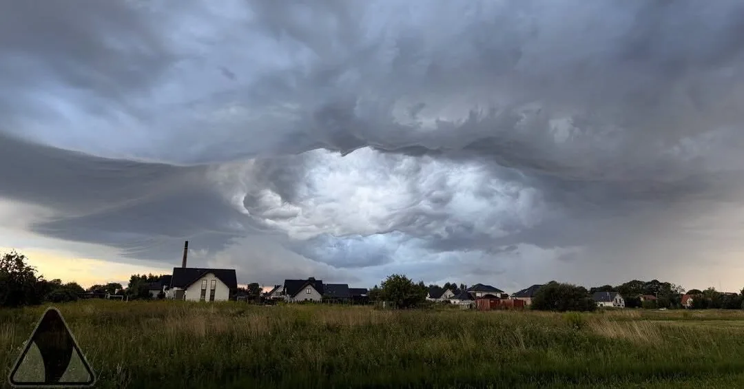
According to Tvnmeteo.pl meteorologist Damiano Zdoneko, on Monday a cold atmospheric front will be felt in Poland, bringing much cooler weather from Scandinavia. So on the first day of the week, it will be cloudy in Poland, with heavier rain in some places and lighter rain in others, and local storms may form.
It already rained briefly in the south of Poland in the morning. During the day, clouds may bring heavy downpours, with 20-40 liters of precipitation per square meter falling in a short time, and hail may fall in some places.
Most storms are expected late in the afternoon, forming in the southern regions, but they may also occur in central Poland.
The night into Tuesday will also be rainy. Meteorologists’ forecasts show that about 10-20 l/sq.m of rain will fall in eastern Poland and parts of the central regions within 12 hours, and in some places, as forecasted – in Mazovia, precipitation may reach 30-40 l/sq.m.
As stated by tvn24.pl, most of the rain will be of moderate intensity, but there may also be intense short-term downpours, with continuous rain in some areas.
So, considering Monday’s storms and rain, up to 60 l/sq.m of water may fall in some places within 24 hours. Such an amount is already described as extreme.
On Monday morning, the Government Security Center issued warnings about possible storms to residents of three voivodeships – Opole and Silesia, as well as parts of the Lesser Poland voivodeship. Warnings are issued due to forecasted storms, strong winds, and heavy precipitation. Power supply may also be temporarily interrupted, and people are advised not to be in open areas.
Read more Drones launched from Iran towards the office of the Prime Minister of Iraqi Kurdistan, officials say
The Polish Institute of Meteorology and Water Management (IMWG) sent its warnings to several voivodeships, with the threat level being the second, orange, in some areas.
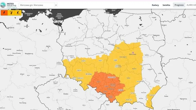
This second threat level is forecasted for the three mentioned voivodeships, where heavy rain may fall, wind gusts may reach up to 25 m/s, and hail is possible. The warnings are valid on Monday from noon until 10 p.m.
Lower – first – level warnings for possible storms have been issued in five other voivodeships – Lower Silesia, Holy Cross, and parts of Lubusz, Greater Poland, and Lesser Poland voivodeships. Strong thunderstorms accompanied by heavy rain (20-35 l/sq.m) and gusty winds (up to 20-22 m/s) are forecasted here. Hail may also fall in some places.
The Lithuanian Hydrometeorological Service does not currently forecast such extreme phenomena in its specialist commentary. It is stated that on Monday, short rains and possible thunderstorms are expected in many places, mostly in the western and northern regions. Winds will be southwest and west at 7–12 m/s. Temperatures will range from 18 to 23 degrees Celsius.
On Tuesday night, rain will fall in some places, and during the day, short rains will prevail in many areas. Winds will be weak at night, and from the northwest and north during the day at 5–10 m/s. Temperatures will be 8–13 degrees at night, 14–17 degrees on the coast, and 16–21 degrees during the day.
However, the maps of dangerous phenomena have already turned yellow for both Monday and Tuesday.
Read more Lithuanians increasingly prepared for surprises: financial cushion grew over a decade